I was better prepared. Continue reading
The Windsor Locks Canal Trail annually opens on April 1. I was on the trail along with quite a few other walkers on the first day. I was shocked to see how much snow was there. The trail is paved with asphalt. In the rest of the area all the paved areas had been bare for a week or more – except of course where huge piles had been made by trucks clearing parking lots. Furthermore, there are very few coniferous trees on the trail. In the spring most of it was subject to direct sunlight most of the day.
I had made two big mistakes on my first trip to the park: I wore my sneakers, which meant that I had wet socks for the return trip, and I did not bring my camera. I resolved to return on the next day, Thursday, which promised delightful temperatures in the sixties, to rectify my errors.
I was surprised to find only one other car in the parking lot in Suffield. There had been at least ten on Wednesday.
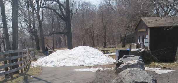
The mound of snow that seemed to block the entrance to the trail was nearly as formidable as it had been on Wednesday. However, it was possible to walk between the cabin and the mound. On Wednesday that area had been covered with a thin layer or water, but on Thursday it was dry.
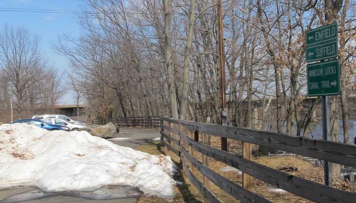
The blue car is mine. I was not lying about only one car in the lot. The other car arrived shortly after I did.
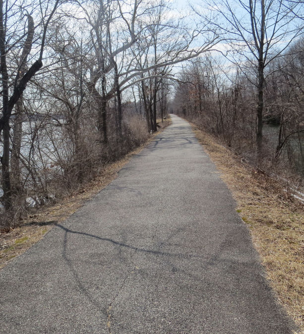
People who ventured out on the trail on Thursday had no reason to suspect that any snow would be left on the trail. This was the first view after crossing the bridge. On Wednesday there had been a few patches of snow here.
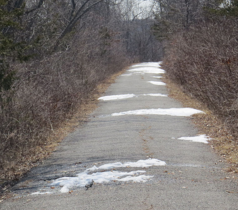
On Thursday the first snow patches appeared after the first bend in the trail. It was easy to walk around the first few, but there was still plenty of snow in the second quarter of the 4.25 mile trail.
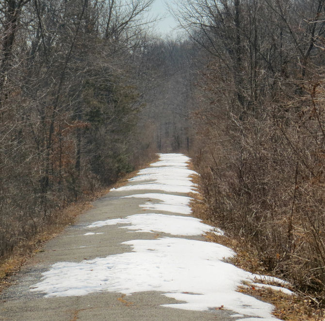
The one-mile marker is just before the left turn in the above photo. By the time that I reached it I was glad that I had left my sneakers at home.
Nearly the entire area in the above photo had been covered with snow on Wednesday. The bike tracks must have been made on Thursday. No bikers made it this far south on Wednesday.

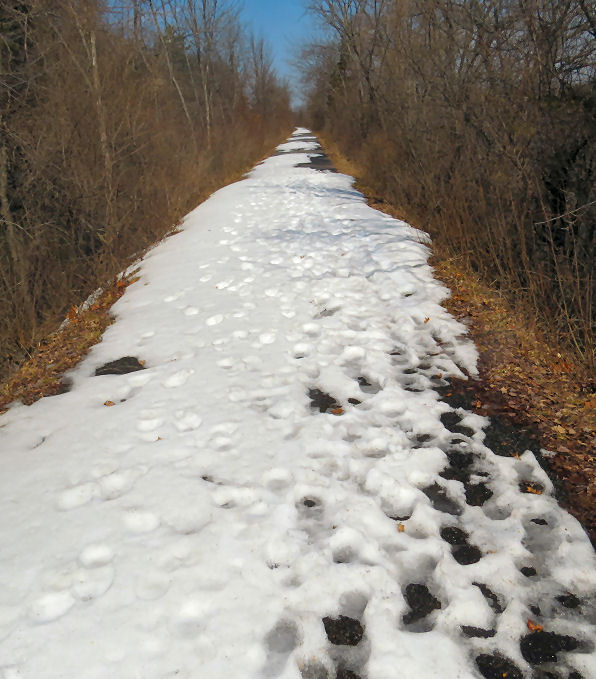
This is the point, about 1.7 miles from the northern gate, at which I gave up on Wednesday. The Thursday cyclist did not attempt it either. I pressed on. My goal was to make it at least halfway.
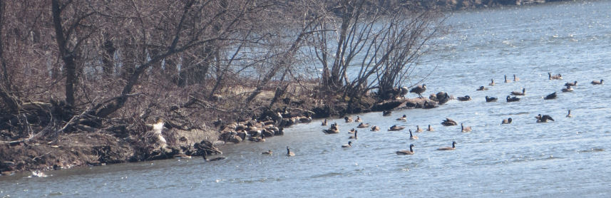
The geese were congregated near a small island to the northeast of King’s island. I could hear them much better than I could see them as black specks on the river. They were approximately 200 meters away.
During last summer, which was exceptionally dry, the river contained hundreds of tiny islands. Nearly all of them were now completely submerged.
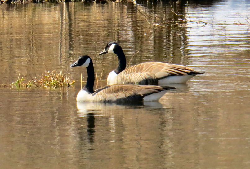
The only Canada Geese that I saw in the canal were this pair of lovebirds. I also disturbed a few pairs of wood ducks who were probably engaged in naughty behavior in the weeds along the bank.
Other birds were also flitting around. I even saw a few moths. The gnats that plague the summer months were not yet in evidence.
I saw no ice whatever in the river. In a few places the canal was still partially covered in white.
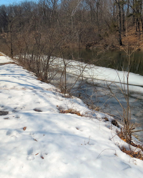
The bridge is roughly the halfway point on the trail. South of it there was almost no snow on the trail. Neither bank had any snow to speak of.
An iceberg in the canal! This one could not have sunk the Titanic, but it might do some damage to a kayak. Fortunately, boats, canoes, and kayaks are banned from the canal.
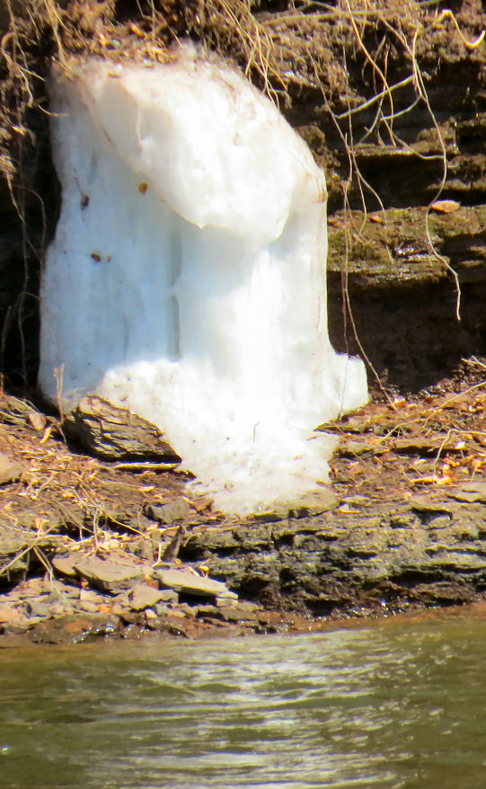
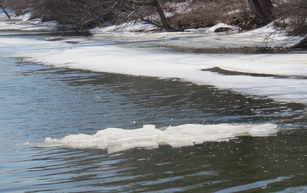
This weird-looking thing was on the other side of the river. I was lucky to get a pretty good photo of it. It was presumably made of ice, but even that is just a guess.
On Wednesday I could hear water flowing at a fairly rapid rate at one point on the far side of the canal, but it was in the shadows, and I was never able to see it. The phenomenon was no longer in evidence on Thursday.
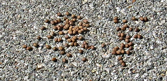
Scat on the trail: can anyone identify it? Each pellet was about 3/8″ in diameter.

I love this photo of one of the few places in which ice covered the canal from bank to bank. That bicycle track interests me. Did someone try to pedal from the eastern shore to the bank or vice-versa? If the latter, did they make it to the shore? The track appears to end, and there is no returning track.
Of course there may have been more ice a few days earlier.
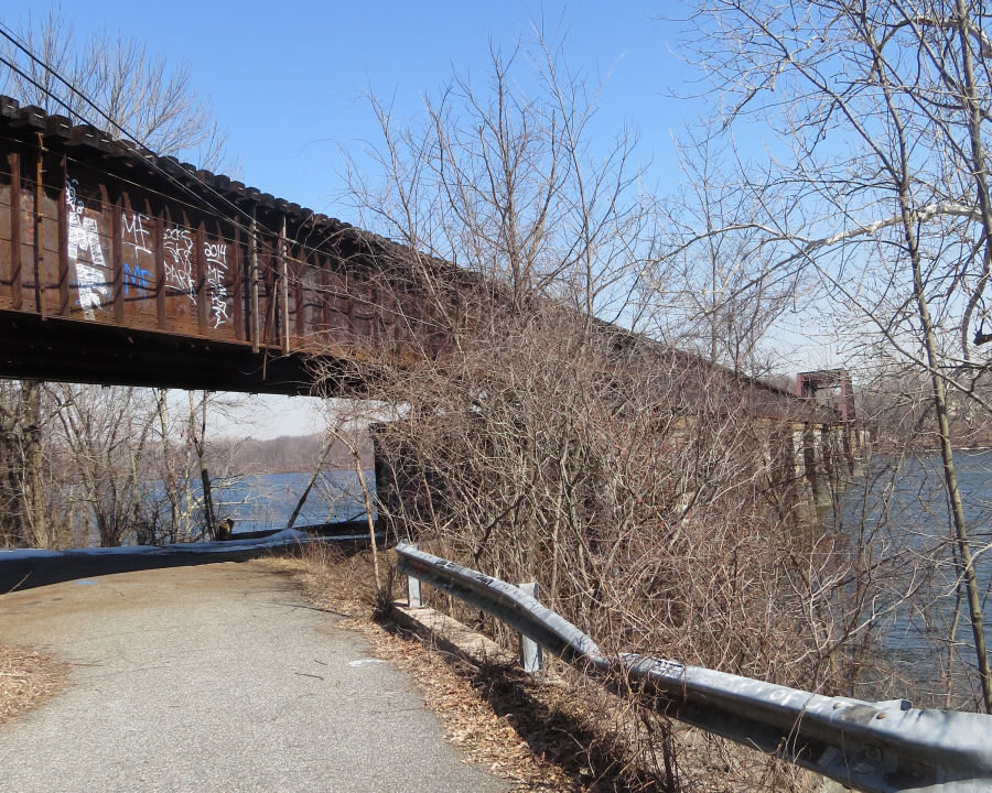
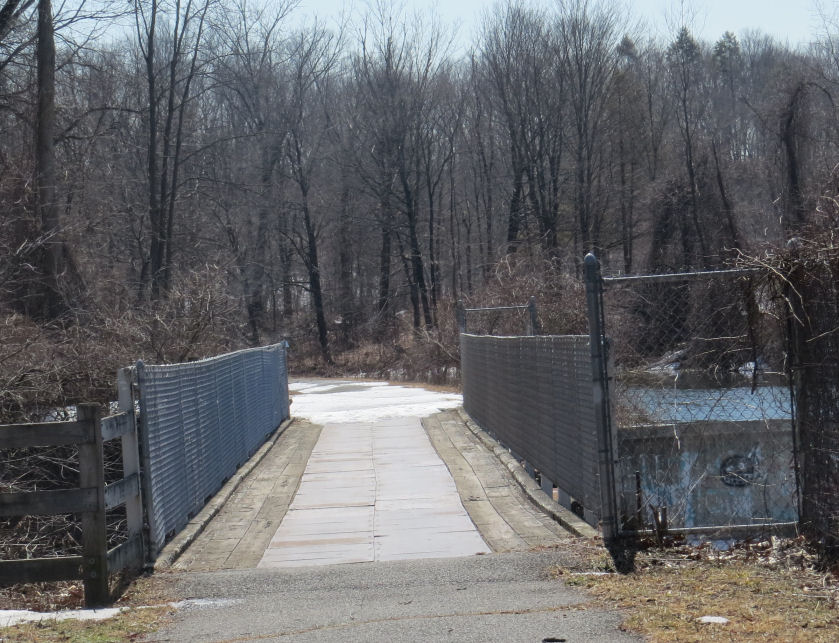
The railroad bridge is one mile north of the Windsor Locks gate. It is still used by Amtrak, an occasional freight train, and graffiti artists.
I did not encounter a single person until I reached this point – over three miles in the company of no one.
I was a little surprised that the last mile of the trail was open. In the last few years it did not open until July in order to give some privacy to a pair of breeding eagles. Maybe they did not show up this year.
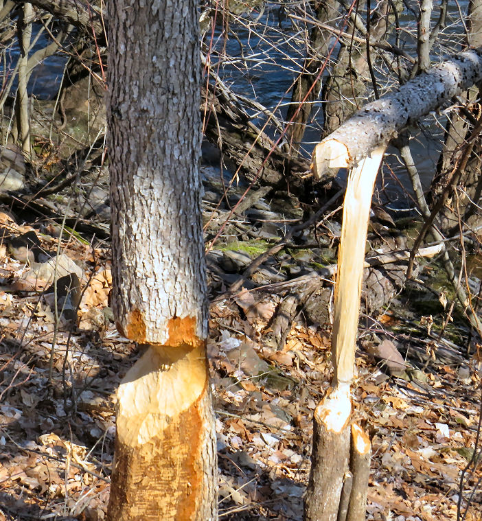
I did not see any beavers on either hike, but they have evidently been busy.

The noisiest part of the hike was when this helicopter flew directly overhead. My first thought, naturally, was that Obama and the U.N were coming after our guns. When it disappeared over the horizon I resolved never to venture out again with so little firepower.
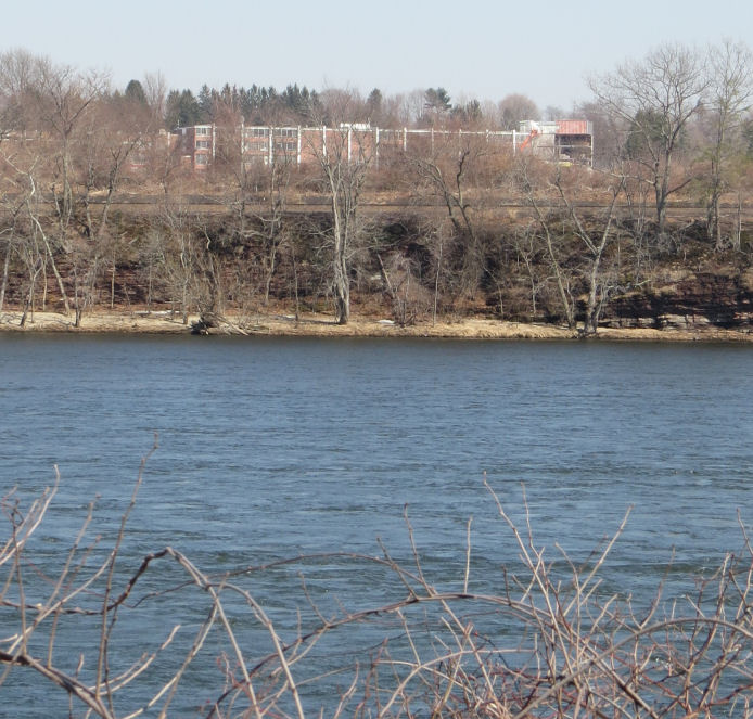
Enfield High School is located close to the river. In six weeks or so it will be completely hidden from the view of the users of the trail by the foliage.