 1995 December: Hawaii Trip Part 2
Sue and Mike on Oahu and Kauai. Continue reading
The part of the trip to Hawaii in 1995 that dealt with business is described here.
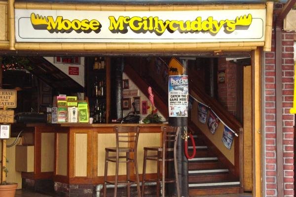
After we dropped Doug at the airport, Sue and I met her cousin Joe Slanec1 and his wife Tamara for supper at Moose McGillicuddy’s2, a famous watering hole in Waikiki. At the time they lived in Ewa, which is west of Honolulu. I think that Joe was in the Navy. He was later stationed on Okinawa, where he managed a commissary. I remember him mentioning at a family gathering how excited he was about selling items over the Internet.
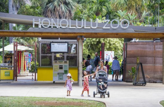
Sue and I also spent a delightful day at the Honolulu Zoo. I bought myself a souvenir hat, and I wore it for quite some time before I left it on a plane or in a hotel room. My most vivid memories of the zoo were of the giant tortoises and some very scary black flightless birds that were about three feet tall. I don’t remember the species.
As we drove around we listened to the radio, which played mostly Hawaiian music. I really liked one of the performers. I bought a CD or a tape of his songs, but it did not include the one that I liked. I am not sure of his name because I could not find the recording.
We also picked up a few words of the Hawaiian language. The ones that we heard the most were “Mele Kalikimaka“. Every other song was a Hawaiianized Christmas carol. The most outrageous was “Winter Wonderland”: “… on the beach we will build a sand man.” One thing is certain. Absolutely nobody associates Christmas with decorated palm trees.
I remember Sue and me taking a jeep tour for a couple of hours. The guide pointed out World War II-era bunkers and the like constructed when an invasion by the Japanese was feared imminent.
We also went to a club that featured a famous comedian of Portuguese (and many other nationalities) descent named Frank De Lima. Most of those in attendance were locals. However, they had no trouble recognizing us as tourists. They tried to get us to sit in the front row of the audience, but I declined. I think that we were in the second row. The people in front became part of the act, willy nilly. Frank was fairly gentle with them, and everyone had a good time.
On Sunday December 10, the Honolulu Marathon was held. Thousands of people were in town to participate. On Saturday evening many restaurants featured all-you-can-eat spaghetti dinners for runners who wanted to carb up before the race. The runners and their entourages lined up for the feast.
It was very hot on the day of the race. I went out for a run in the morning, and it really felt good. In those days the heat never bothered me much. The real runners were all participating in the marathon. That made me the fastest pedestrian on the road.
The marathon’s course ran mostly on city streets from Ala Moana Center to Diamond Head and back. That meant that the first half was uphill, and the second half was downhill. 27,000 people finished the race, a new record. The temperature (88°) was also a record.
Before returning our rental car Sue and I drove up to the north shore where the famous set of waves called the Pipeline is located. The surf was not up that day, and so there was not much to see. On the way back we stopped at Dole’s Pineapple Plantation. I don’t honestly remember much about it.
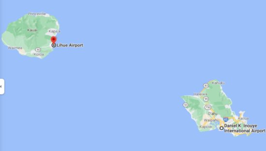
I definitely remember the flight from Honolulu on the island of Oahu to Lihue, a much smaller town on the southwest corner of Kauai. When there was a few minutes to go before our plane boarded, Sue disappeared. I ran around looking for her, and I almost had to drag her out of the gift store.

Kauai: The flight from Honolulu to Lihue only took a little bit more than half an hour. We landed in the Lihue Airport in the evening. We gathered our luggage, picked up our rental car, a Chevy Geo.
We had to trust the directions that had been provided to us for reaching our lodging for the first two nights. We were staying in a highly unusual place, and it was not too easy to find. This was before cell phones, and no one had any idea what GPS stood for. However, we were in an adventurous mood, and we had quite a lot of experience in using maps. We eventually found it.
I don’t know what to call the place in which we stayed. I don’t remember what it was called, I also don’t remember where we heard about it, and I could find nothing like it on the Internet. It was run by a young couple. They had bought some property near Kapa’a, the largest town on the island. However, their property was pretty far inland. On Kauai that meant that it was largely jungle. They had built a few small cottages amidst the trees, bushes, and plants. They rented the units out by the night. We stayed two nights.
It was dark when we arrived. The lady grabbed a flashlight and escorted us down the path to our room. There was no extra charge for the geckos on the walls inside. The bathroom was not accessible from the bedroom because of a tree that the owners had built around. Remember: this was in the jungle. To go to the bathroom we had to walk out on the lanai and go around the tree. My recollection is that the land fell away rapidly from our living quarters down to a stream, but I may be mistaken.
Sue and I both loved this place. It was absolutely unique, and we got along well with both proprietors. They had banana trees from which we were allowed to sample.He was a very energetic guy who. while we were there, spent his days bushwhacking trails. He also gave me some good advice on hiking.
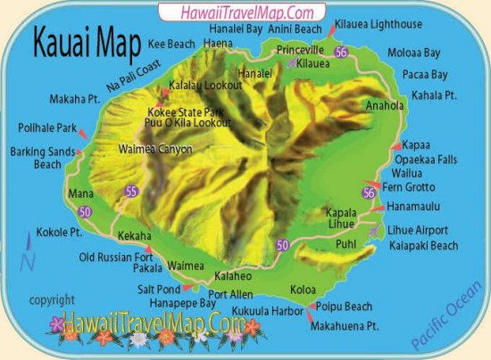
Kauai is roughly circular. In the middle is Mt. Waialeale, which at the time was considered the rainiest spot on earth.The beaches on the west coast, just a few miles away, receive only about 10″ per year.
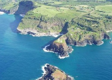
There was really only one major road on the island, although it is numbered as 50 in the south and west and 56 in the north and east. The road was paved throughout, but for the most part there were only two lanes. The resort areas were Princeville in the North and Poipu on the south coast. The highway died on both ends when it reached the Nāpali Coast. Almost everyone in Kauai lived within a few miles of the coast, and most of them were on the east coast.
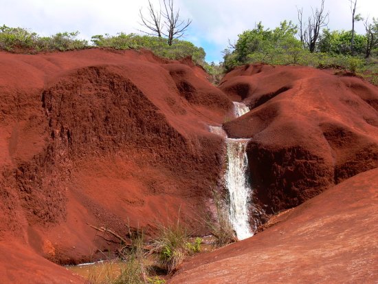
The dirt on most of the island was red. Everything anyone owned or used eventually was stained a reddish brown color. The stains were essentially impossible to remove. The locals just put up with it. For tourists the best strategy was probably not to change clothes as long as you were on Kauai. After you left the island, you could keep the stained items as souvenirs or throw them away. The other strategy was just to stay in one of the resorts. I am just mentioning it for completeness; I would never consider that option in such an exciting place.
One of the first things that Sue and I did was to take a short hike together to view a waterfall that was near our cabin. I don’t remember the name of the waterfall. They are a dime a dozen on Kauai. We also drove to Wailua Falls, which was featured at the beginning of every episode of the television show Fantasy Island. “Boss, the plane!”
I think that on the first day we drove to Kilauea Point to look at the incredible display of seabirds in and around the neighboring cliff. You could walk from the parking lot right out to the lighthouse constructed at the end of the point. The walk toward the lighthouse provided a spectacular view or the nesting grounds on the hills across the bay on the right.
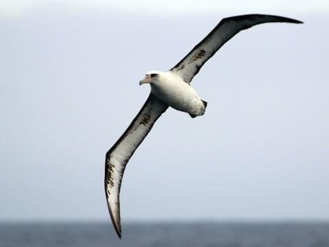
While we were near the lighthouse, three Laysan albatrosses were out in a protected area on the point just a few feet away from the tourists. When they stretched their necks, they came up to my belt. Once or twice one took off or landed. Their wingspan was enormous, roughly two meters.
Sue and I were into birding in those days. I am pretty sure that we had a handbook that identified the birds in Hawaii. There were also displays there that identified the seabirds.
We then drove west to Hanalei and on the “Wash That Man …” beach we got the promised view of Bali Hai. We might have also taken the boat ride up the Nāpali Coast at that time. The scenery as viewed from the ocean was absolutely breathtaking.
I remember that near the end of the highway we drove west across a small shallow stream. We did not stop driving until the road ended.
I had really wanted to try to hike the Kalalau Trail, which is the Holy Grail of hiking in Kauai. For eleven miles it goes up and down the coast where there has never been a road. There was only one entrance. So, the total hike was twenty-two very rugged miles.
I could conceive of no way to do it. It would have been too dangerous4 to attempt it by myself. Furthermore, it would take three days, and you must register in advance. Unfortunately, I was almost certain that I would probably never get this chance again. I was in good enough shape to do it, but I was forty-seven, extremely busy, and not getting any younger.
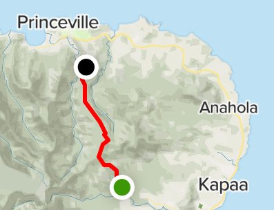
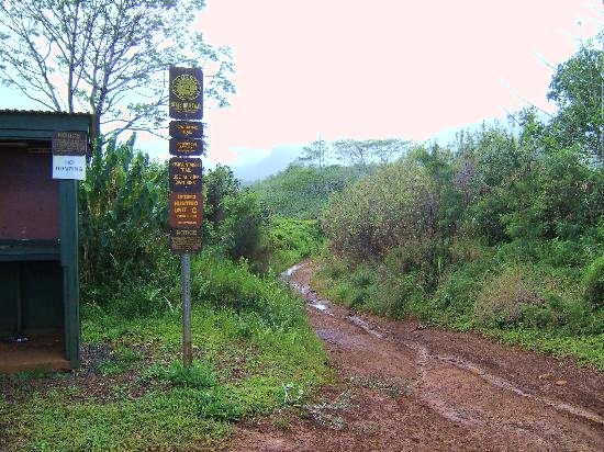
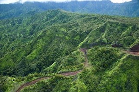
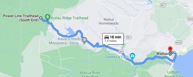
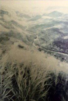
Instead, on our second full day on the island I hiked the entire Powerline Trail5, which was about nine miles with a gain of 1800′ in elevation. It wass named after a set of power lines that were always in view but were almost never directly overhead.
I started at the northern trailhead, just south of Princeville. Sue dropped me off in the morning. The temperature was still in the eighties. I brought quite a bit of water and a picnic lunch with me. Sue agreed to pick me up at the southern trailhead at, if memory serves 3:30. This spot could be reached on a road from Wailua, the town just south of Kapa’a.
I had a marvelous time. The trail was quite easy for the first mile or so. It was actually a road. After that the going got a little tougher, but the views provided more than adequate compensation for the effort. There was little or no shade, but the heat did not bother me in those days. More to the point, there was very little mud.
I enjoyed about as clear a view of Mt. Waialeale as is possible—it is almost always surrounded by clouds. At one point I stopped and counted waterfalls. I would swear on anything that I could see fifty-one of them at one point. It was awe-inspiring.
I don’t remember too many of the other details. I stopped for lunch when I came to a rock that was large enough to sit on. I also remember that near the end of my hike I encountered a young lady who was hiking by herself. She started at the north end and was going south. What was distinctive about her was the very large straw hat that she wore, presumably to protect herself from the sun. When we crossed, we both just said “Hi” and continued on.
She probably was going to walk a few miles and then return to the southern trailhead. Unless she had night vision it was probably too late for her to traverse the whole trail.
I arrived at the southern trailhead about fifteen minutes before our scheduled meeting time. Sue was, as usual, late. As I recall, there was a picnic table near the parking lot. So, at least I had a seat. I had considered bring a book with me, but I figured that I would have regretted the additional weight somewhere in the middle of the hike. By the time that Sue arrived, I had been out in the middle of nowhere by myself for forty-five minutes. I was very bored and thirsty, and this put me in a bad mood. I don’t remember where we ate supper.

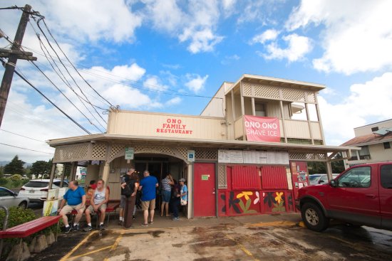
I do remember where we ate breakfast most days. We both liked the Ono Family Restaurant6. Sue liked the omelettes with papaya. I don’t remember what I ate, but I can visualize the place, and every mental reference is pleasant.
I remember that this restaurant is where I first encountered the The Garden Island7, the small daily newspaper. I bought a copy every day. In terms of content it was the smallest daily newspaper that I had ever seen. I did note that some big chains advertised in it. Only 56,000 people lived in Kauai in 1995. Enfield alone had 43,611, lots of retail, and no newspaper8.
We stayed the next two nights at a convenient and reasonably priced hotel called the Kauai Sands9. It was convenient to a small beach south of Kapa’a in Wailua. On the drive there we saw the Coco Palms Hotel that was in Elvis Presley’s movie Blue Hawaii.
Our unit was inexpensive and very comfortable. It even featured an unexpected kitchenette. There was also an outdoor barbecue grill available for guests to use.
Sue and I had been eating restaurant food for a week. The food at restaurants in Hawaii was OK, but the best food there was fruit and fish, both of which are plentiful in the middle of the Pacific Ocean. Everything else was quite expensive. This was not the fare that my fellow Kansans were accustomed to consuming on a regular basis.

We decided to treat ourselves to a home-cooked meal of steak, rice, and green beans. We drove to a grocery store that we had accidentally discovered when looking for something else. There we bought some steaks from a ranch on the Big Island and everything else that we needed for supper.
It was my job to cook the steaks. I started the fire easily enough. I was just about to put the steaks on the grill when the rain started—the only rain that we encountered on the entire trip. It did not rain very long, but while I was tending the steaks it was pouring. When they were done, I sprinted with them to our hotel room, but I still got a soaking. I laughed it off.
The steaks were a little stringy, but everything else was good, and we got a good vacation story out of it. Rain does not play a major role in most people’s adventures in Hawaii.
There was no rain during the hours that we spent on the Wailua River, the only navigable stream in all of the islands. We started by taking the large boat out to Smith’s Fern Grotto, which was (and still is) a popular spot for couples to get married. We did not do that. We just looked at the foliage that had been pretty well wiped out by Hurricane Iniki in 1992. Most had grown back.
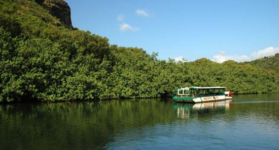
The boat held 2 or 3 dozen. 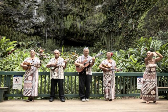
The band came with us. 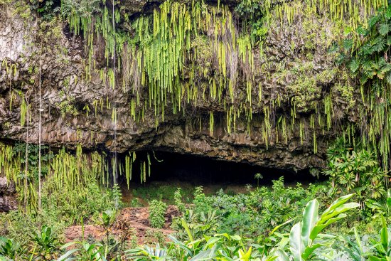
The Fern Grotto.
On the boat ride a small group played Hawaiian music. Two hostesses made everyone try to hula. Needless to say, Sue was much better at it than I was.
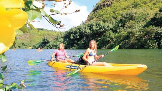
Our other outing on the river was a nightmare. We decided to rent a two-person kayak and go up the river on our own. I don’t remember whose idea it was, and I can hardly imagine that either of us expected to have a good time. Our first clue to the fact that this would never work was when the guy giving us our thirty-seconds safety briefing told us that the biggest and strongest person should sit in the back. He was stumped when I informed him that those were two different people. The person in the back provides the propulsion. The one in front does the steering. To to right, paddle on the left side.
I sat in the back on the way upstream. That seemed like the best choice at the time, but Sue was not strong enough to keep us from drifting to the center of the river. At one point the large boat taking people to the Fern Grotto blew a loud horn at us. The return trip downstream was only a little better. We traded places, but Sue was too tired to paddle much.
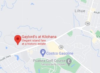
We spent the last nights in Kauai at Koke’e Lodge, which was (and still is) located in a remote corner of the western side of the island. Before we left, however, Sue and I put on our Sunday-go-to-meeting outfits one evening and went to Gaylords Restaurant for supper. The restaurant is in a large plantation house called Kilohana, located southwest of Lihue, a little way off of the main road.
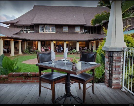
This place was definitely upscale. We toured the plantation house for a few minutes. Then we were seated at our table, which was outside. It was a beautiful evening, and the setting was truly stunning. The food was just OK, but we knew that we were really paying for the atmosphere. It was the only time that we really splurged on the whole trip.
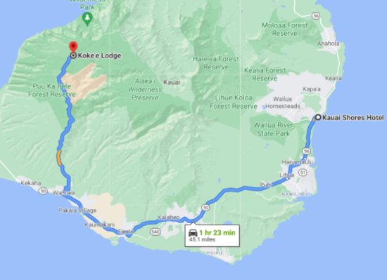
The drive to Koke’e Lodge was somewhat challenging. We left right after breakfast, and it was almost noon by the time that we reached the lodge. The Geo was not happy about the part of the journey represented by wiggly blue lines on the map at left. That is the area in which we drove on switchbacks up to 3,800 feet . On our right was Waimea Canyon. On our left the land fell more and more steeply towards the ocean.
We never needed the Geo’s four-wheel drive at any time, but we could have used a little more horsepower on this journey. The poor little guy was really struggling.
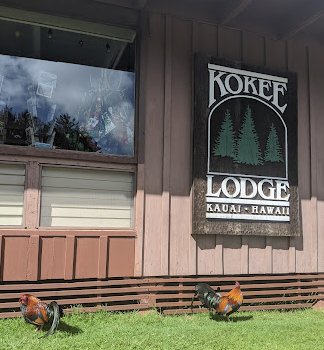
The accommodations at the lodge were a little spartan. The cabin had bunk beds and a furnace as I recall. It was cheap and very convenient for exploring the most spectacular scenery in Hawaii, if not the world. Koke’e State Park offers spectacular views down towards the canyon on one side and down towards the Nāpali Coast on the other.
My recollection is that we only stayed at Koke’e Lodge one night, but in retrospect it is hard for me to figure out how we could have done as much as we did and still made it back to Lihue for our flight to Kahului. Maybe we stayed two nights.
I undertook my second epic hike while we were staying at Koke’e Lodge. I am not sure what the names of the trails were, but I suspect that I could find them if I went back to the area—without a map—even though almost twenty-six years has passed between the time that I was there and the time that I finally got around to writing about it.
There were four trails. Three of them were roughly parallel and ran from the highway west toward the ocean. Each was about a mile or two in length, and each sloped rather gently through the forest. The fourth trail ran north-south and connected the endpoints of the other three trails. The north-south trail ran along the side of the hill/mountain and afforded stunning views of the ocean and the steeply sloping land between the trail and the ocean. Each of the trail’s two legs was also a mile or two.
My plan was to stroll down the northernmost of the three east-west trails, hike the entire cliffside trail from the north end to the south end, and then walk up the southernmost east-west trail back to the highway, where Sue would pick me up. There was one awkward difficulty. The part of the cliffside trail that linked the northern trail with the middle trail was closed. I directed Sue to leave me off at the entrance to the northern trail anyway.
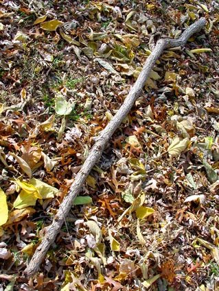
The walk on the northern trail was delightful. The trail was well maintained, and the atmosphere was quite invigorating. Best of all, I found a very good walking stick early in the journey. When I reached the end of the trail, the view of the ocean and the sloping land down to the ocean was exceptional.
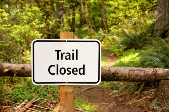
There was indeed a sign that said that the trail going south was closed, but there was nothing that prevented or even actively discouraged walking on it. So, I decided to give it a go. The path was narrow, and the slope of the falloff was severe in spots. On the other hand, there was quite a bit of bushes and shrubbery on the hillside. Even if I slipped, I was fairly confident that I could stop myself and scramble back up onto the path. It was steep, but it wasn’t that steep.
I encountered no difficulty until I was within a quarter of a mile of the intersection with the middle trail. The trail had washed out. I could see the trail on the other side of a patch of about fifteen or twenty feet. Getting to the rest of the trail would definitely be tricky. If I had been sensible, I would have turned around at this point and returned back the way that I came.
Instead, I put one foot forward. The ground held. I planted the stick ahead of me on the downhill side and took a step. So far, so good. I only had to repeat this process three or four times to make it past the dangerous area. Whoever decided to close the trail definitely made the right decision, but I never came close to slipping.
Shortly before I reached the southernmost trail, a truly amazing thing occurred. I once again crossed paths with the lady with the big hat. We exchanged greetings again. I think that we both were amazed. There were literally hundreds of hiking trails in Kauai. I had encountered only a few fellow hikers on either occasion and only one singleton, and I saw her twice on separate days on the opposite side of the island!
The whole experience was truly exhilarating. There is something about accepting danger and then overcoming it that is very satisfying. Maybe it has something to do with testosterone. I was in an exceptionally good mood when Sue picked me up on the highway near the southern trail.
Sue’s photo of Waimea Canyon. 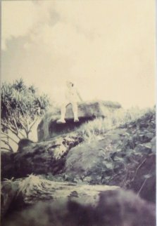
This is me sitting on a big rock.
Sue and I both spent quite a bit of time in Koke’e State Park. There are dozens of interesting trails here. We walked out together to one of the overlooks of the Nāpali Coast. The view was amazing. People lived in that rugged land at one time, but no one has attempted to civilize it in centuries.
I had hoped to find time to hike the trail that led to and then through the Alaka’i Swamp, which is literally like nowhere else on earth. It is the world’s loftiest rain forest. Unfortunately, I could not figure out how to work it into the schedule.
On our last day Sue ran out of energy. She wanted to hang around near the lodge. I recall that some guys were getting together a pig hunt. Sue just wanted to spend some time taking photos of flowers and birds. I took advantage of this to take a quick journey on the Pihea Trail, the one that leads to the swamp trail. I walked it at a very fast pace. I stopped to look at only a few sights, notably the view of the canyon. I got as far as the start of the boardwalk, but I needed to turn around before I actually reached the swamp trail. I had already been gone longer that I said that I would.
So, maybe next time for the swamp trail. Whom am I kidding?
I also had a goal of hiking the canyon trail, but there was no time for it. The helicopter tour would have been exciting, but it was also expensive and somewhat time-consuming.
So, we terminated our stay on Kauai by driving the Geo back to Lihue. The Geo liked driving downhill a lot better tShan the trip up to Kope’e. We stopped to fill up the car with gasoline before returning it. Then we got our tickets and flew to the Kahului Airport on Maui.
I fell deeply in love with Kauai. I gave serious consideration to moving our residence and the business there. We did most of our business using phone lines. It was a pipe dream. Sue would not be able to stand it, and, even if Denise agreed, we would need to hire new employees. Sigh.
The description of the remainder of the Hawaii Trip is posted here.
1. Sue’s family’s name is Slanetz. In the Slovak language the last letter looks like a c but is pronounced like tz. However, Joe pronounces his last name SLANN eck.

3. Hawaiian pronunciation is rather easy. There are only twelve letters, and they are pronounced consistently. The vowels have the same sound that they have in Italian or Spanish. “Kauai” is somewhat difficult because of the four consecutive vowels. Until I heard someone pronounce the name of the racehorse, Kauai King, I thought that it was pronounced COW eye. In actuality, it has three syllables, with the accent on the second one: kah WAH ee.
2. Moose McGillicuddy’s closed for good in February of 2021.
5 The trail is still open, but its website (available here) lists such potential dangers as falling rocks, flash flood, strong current, hazardous cliff, and dangerous shorebreak.
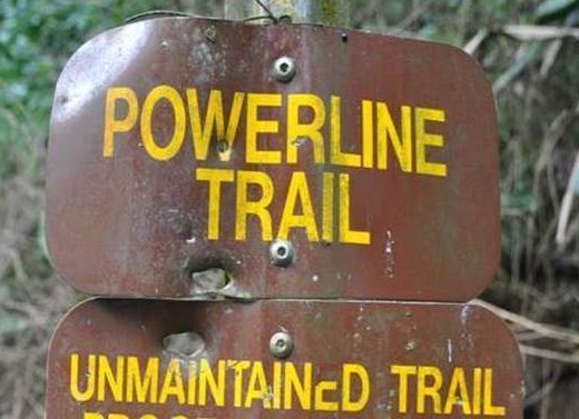
5. I was considering replicating this feat on our second trip to Hawaii in 2018, but when I looked the Powerline Trail up on the Internet, I discovered that it was no longer maintained. That was a virtual guarantee that parts of the trail were overgrown, and parts were probably swamp. It did not sound like a good idea for a septuagenarian.
6. The Ono Family Restaurant survived for two decades after we ate breakfast there, but it could not survive the pandemic. It closed for good in 2020.
7. The Garden Island actually became a client of TSI when Macy’s West, which used AxN, TSI’s Internet service for insertion orders (described in detail here), acquired Liberty House. They continued to subscribe to the service until TSI’s last days in 2014 even though control of Macy’s advertising had earlier been transferred to New York in 2009. That office did not use AxN, for reasons that are described here.
8. Since I had twice been an editor of a newspaper—News and Views in eighth grade and Rumsey Roomers in college—I have occasionally considered starting a newspaper for the town in which we lived. Only one name was appropriate: The Enfield Flyrule.
9. When we stayed there it was run by the Kimi family. The people who bought it from the Kimis changed the name to Kauai Shores. I don’t understand the use of the plural. Nearby, there are certainly lots of sands, or at least grains of sand, but only one shore.